Devon · EX3
Drone survey in Topsham
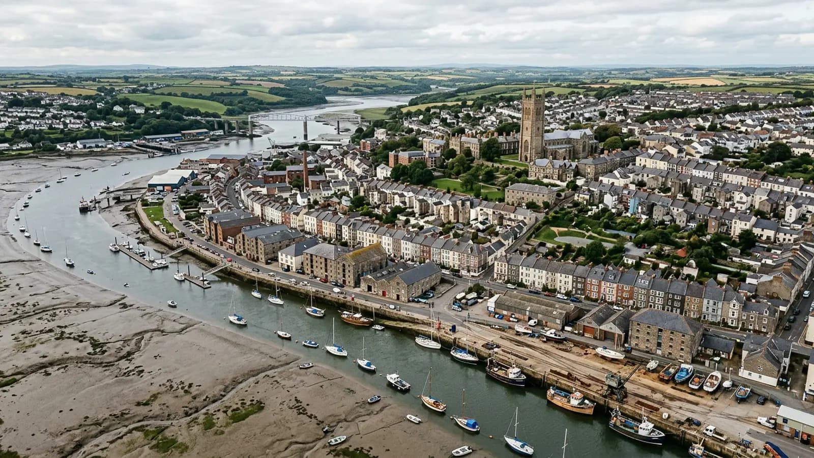
A listed estuary town where the roofs are old, the salt air never lets up and the streets are far too tight to get a scaffold anywhere useful.
Listed buildings and the access problem
Topsham's historic core is a dense run of merchant houses and cottages, a great many of them listed, with Victorian and Edwardian streets behind and modern infill towards the Exeter road. The roofscape includes natural slate, clay pantile, lead and zinc detailing and the Dutch-influenced gables the town is known for, which is a lot of different materials meeting each other at a lot of junctions.
The awkward part is reaching any of it. The Strand and the lanes off it were laid out for carts, and a scaffold on a listed frontage is a planning conversation as well as a cost. That is the specific reason aerial photography took hold here early: it produces a close look at a gable, a parapet or a zinc detail with nothing standing on the pavement and nothing fixed to the building.
Salt on three sides
The town was built right up to the water on the west bank of the Exe estuary, with salt marsh and mudflats around it. Estuary air is damp and salt-laden all year, not just in storms, and the wind runs straight up the estuary from the south so that rain is driven hard at south-west facing slopes.
What that does to a building is mostly about fixings and metalwork. Nails corrode faster than inland, lead and zinc work harder, and any ferrous fixing on an exposed elevation has a shorter life than the same fixing three miles up the road in Exeter. Those are all small components that fail invisibly and are only obvious in a close photograph.
What a flight looks like here
Tight. Take off ground is the first thing to solve, because many of the older properties have no off street space at all, and the answer is often a quayside space, a garden behind or a neighbour's yard with permission. That gets arranged in advance rather than found on the day.
The estuary itself is an advantage once the aircraft is up. There is open ground and open water on the eastern side of the town, so the standoff distances that are difficult inland are easy here, and elevations facing the water can be photographed from a position that does not sit above anybody's garden.
Listed consent and the value of a record
For a listed building, a photographic record has a use beyond finding a defect. Anybody applying for consent to repair or alter has to describe the existing fabric, and a set of dated images of the roof and the detailing is a better description than a paragraph. Conservation officers are looking at the same things a survey photographs.
It also matters for the reverse case. If a repair is refused or queried, the record of what was there before the argument started is worth having, and it is much easier to gather while nothing is urgent than during a dispute.
Behind the survey
What Topsham clients are actually buying
CAA registered
Registered with the Civil Aviation Authority as an operator, with both an Operator ID and a Flyer ID held. Anybody flying a camera drone for you should hold both.
A2 Certificate of Competency
The qualification that covers flying closer to buildings and to people than the basic rules allow. It is not a GVC and this site does not claim one.
Insured with Coverdrone
Commercial flights are covered by a Coverdrone policy. A copy of the certificate is available on request, and most managing agents will ask for it.
One named surveyor
Sam Hembury plans and flies every job himself and writes up every report. There is no crew and no subcontractor, so the person you speak to is the person who turns up.
DJI Mavic 4 Pro
A 100 megapixel Hasselblad camera and 6K video. That resolution is the reason a cracked mortar joint is readable in a photograph taken from twenty metres away.
DJI Mavic 2 Enterprise Advanced
Carries a 640 by 512 radiometric thermal camera alongside the ordinary one, which is a different job: heat and moisture rather than condition.
Report within 48 hours
The written report follows the flight within 48 hours. It is a process commitment rather than a promise about what the report will find.
Construction background
The reports are written by somebody who worked in construction before flying, so a defect is described in the words a builder or a roofer will use back to you.
Nearby
Also covered around Topsham
- ExeterThe city where the surveys are based, with a building stock that runs from Georgian terraces to last year's estates, and a river valley that keeps everything damp.
- ExmouthTwo miles of open seafront and unbroken salt-laden south-westerlies, which corrode fixings faster than anywhere inland and lift ridges and verges every winter.
- Budleigh SaltertonSubstantial detached houses in generous plots, many long-held and lightly altered, which means original roofs quietly reaching the end of their working life.
See what it costs
Get a quote in Topsham
Send the address and what is worrying you. Sam Hembury will come back with a fixed price and the next slot that suits the weather.